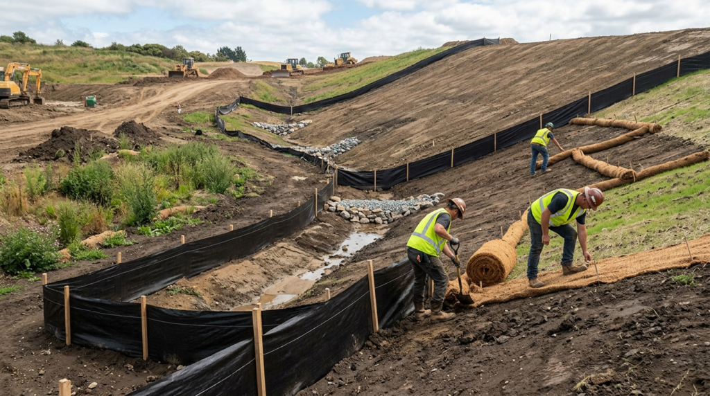
Quick answer: You usually need an erosion control plan when your project will disturb soil and could send sediment into streets, storm drains, wetlands, or nearby water. Many towns and conservation commissions require one for grading, new driveways, additions, septic work, or any sizable excavation. A plan documents controls and sequencing to improve inspection outcomes and reduce the risk of enforcement actions, depending on local requirements and site conditions.
What an Erosion Control Plan Actually Includes
An erosion control plan is a set of drawings and notes that show how you’ll keep soil on your site instead of washing into catch basins, streams, or a neighbor’s yard. It typically maps existing and proposed grades, drainage flow paths, soil stockpile locations, and the exact placement of temporary and permanent controls.
Common temporary measures include silt fence, compost filter socks, inlet protection around storm drains, stabilized construction entrances to reduce track-out, and temporary seeding or mulch on exposed slopes. Permanent measures often include final grading to direct runoff safely, vegetated stabilization, stone or turf-lined swales, infiltration practices where allowed, and riprap or level spreaders at concentrated discharge points.
Good plans also spell out maintenance: who checks controls, how often after rain, when to replace torn fabric or clogged socks, and what needs to be done before a forecasted storm. Inspectors typically look for clear locations, install notes, and realistic sequencing that can be followed in the field.
A Quick Decision Checklist Before You Apply for Permits
These are common triggers that often lead reviewers to ask for erosion and sediment controls. They vary by town and site, but they’re useful red flags.
If your project includes any of the following, call your building department/conservation commission: noticeable clearing or grading (a common review threshold is around 10,000–20,000 sq ft of disturbed area, but smaller sites can still be flagged), work on steeper slopes (often around 10–15%+), soil stockpiles or excavation near the street, any new driveway or paved area that changes runoff, or work near wetlands, a stream, a pond, or a drainage ditch (a common trigger is work within about 100 feet of a wetland resource area, but local buffers differ). Ask whether they require an erosion & sediment control plan and what standard they follow.
Some communities reference a state stormwater manual, local stormwater bylaws, or conservation commission guidelines for acceptable practices and details. Getting the referenced standard up front helps avoid redesigns and re-submittals.
Common Mistakes That Cause Failed Inspections
The most common problem is installing controls too late. Silt fence and construction entrances are meant to be in before clearing and excavation, not after the first rain. Another frequent issue is putting silt fence in the wrong place—across concentrated flow or at the bottom of a steep slope where it can be overtopped. Silt fence works best for sheet flow and needs proper trenching and staking to stay sealed.
Stockpiles are another trouble spot. A bare pile near the road or a catch basin can generate a lot of sediment quickly. Plans that call for covering stockpiles, keeping them set back from drainage structures, and stabilizing exposed soil in phases tend to perform better. Track-out onto pavement can also draw quick attention; a stabilized entrance and regular sweeping are common, straightforward controls.
What to Send for a Plan and How It Gets Used On Site
To get started efficiently, send a recent survey/plot plan (or the best available base plan), any proposed site layout or grading sketch, and a short description of the work: limits of disturbance, driveway/paving areas, utility trenching, stockpile locations, and the rough construction schedule. Include a few site photos after rain if possible, plus any wetland flags, prior determinations, or permit comments you’ve already received.
Typical deliverables are a plan sheet (or small sheet set) showing limits of disturbance, flow arrows, and the locations/details of each erosion and sediment control measure, plus notes covering installation timing, stabilization methods, and inspection/maintenance responsibilities. That package is commonly submitted with your permit application, then used by the contractor to install controls before earthwork, keep them functioning during construction, and document stabilization at closeout. For help assembling the right submittal and producing a clear plan-and-notes set that your crew can actually follow, contact Haughawout Engineering & Markets.